Difference between revisions of "Maps of Pensacola"
Jump to navigation
Jump to search
m |
|||
| Line 13: | Line 13: | ||
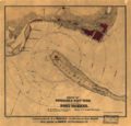
Image:WilliamsCivilWarMap.jpg|1860s ([[Civil War]]) | Image:WilliamsCivilWarMap.jpg|1860s ([[Civil War]]) | ||
Image:WellgeMap.jpg|[[Wellge map]] of [[1885]] | Image:WellgeMap.jpg|[[Wellge map]] of [[1885]] | ||
| + | Image:WatsonMaps1949Repro.jpg|[[1903]] & [[1906]] [[Watson maps]] (1949 reproduction) | ||
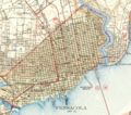
Image:Pensacola fl 1919.jpg|[[1919]] | Image:Pensacola fl 1919.jpg|[[1919]] | ||
Image:Pensacola1942Map.jpg|[[1942]] | Image:Pensacola1942Map.jpg|[[1942]] | ||
</gallery> | </gallery> | ||
[[Category:Maps| ]] | [[Category:Maps| ]] | ||


