Difference between revisions of "Hurricane of 1906"
Jump to navigation
Jump to search
(Nice new image, para on damage) |
(Another image, captions) |
||
| Line 11: | Line 11: | ||
<gallery perrow="2" widths="180px"> | <gallery perrow="2" widths="180px"> | ||
Image:1906hurricane1.jpg | Image:1906hurricane1.jpg | ||
| − | |||
| − | |||
Image:1906hurricane4.jpg | Image:1906hurricane4.jpg | ||
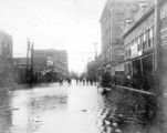
| − | Image:1906Hurricane-damage.PNG | + | Image:1906hurricane2.jpg|Looking northerly on [[Palafox Street]] from just south of [[Romana Street|Romana]]; [[Thiesen Building]] is visible at right |
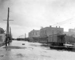
| + | Image:1906hurricane3.jpg|Looking easterly on [[Main Street]] from [[Palafox Street|Palafox]] | ||
| + | Image:1906Hurricane-damage.PNG|Looking northeasterly on [[Baylen Street]] | ||
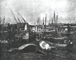
| + | Image:1906Hurricane-damage2.PNG|Remnants of [[Muscogee Wharf]] | ||
</gallery> | </gallery> | ||
Revision as of 21:31, 24 April 2008
The hurricane of 1906 was the sixth storm of the 1906 season. At its maximum intensity, it attained Category 3 status with winds as high as 120 mph. The storm made landfall west of Mobile on September 27, 1906 as a Category 2.
Winds of 105 mph were experienced in Pensacola, and storm surge at Santa Rosa Island was measured at 14 feet.
Damage
The U.S. Weather Bureau's September 1906 Monthly Weather Review estimated the storm's damage:
| In the vicinity of Pensacola the damage is estimated to be: to navy-yard, forts, etc., $1,100,000; by tides along the shores of East Bay, Escambia Bay, etc., $125,000; ... by winds and rain at Goulding, Fla., $13,000; to timber and turpentine interests in Escambia and Santa Rosa counties, $40,000. | ||
—"The West Indian Hurricanes of September 1906" by E. B. Garriott | ||
Images
Looking northerly on Palafox Street from just south of Romana; Thiesen Building is visible at right
Looking easterly on Main Street from Palafox
Looking northeasterly on Baylen Street
Remnants of Muscogee Wharf


