Difference between revisions of "W Street"
Jump to navigation
Jump to search
m (+ category) |
m (+ categories) |
||
| (One intermediate revision by the same user not shown) | |||
| Line 20: | Line 20: | ||
|namesake= | |namesake= | ||
|map= | |map= | ||
| − | |mapcode= | + | |mapcode=<googlemap lat="30.452225" lon="-87.252045" type="map" zoom="11" width="288" height="250"> |
| + | #758bc5 | ||
| + | 30.412188, -87.251015 | ||
| + | 30.427879, -87.249899 | ||
| + | 30.430618, -87.249298 | ||
| + | 30.444308, -87.248783 | ||
| + | 30.446084, -87.248869 | ||
| + | 30.451485, -87.250586 | ||
| + | 30.455111, -87.249813 | ||
| + | 30.463841, -87.252903 | ||
| + | 30.465987, -87.252903 | ||
| + | 30.475677, -87.25625 | ||
| + | 30.481003, -87.25831 | ||
| + | 30.483148, -87.260199 | ||
| + | 30.484998, -87.260113 | ||
| + | 30.486255, -87.258482 | ||
| + | </googlemap> | ||
}} | }} | ||
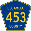
| − | '''W Street''' is a major north-south thoroughfare in [[West Pensacola]]. It connects [[US Highway 98|US 98]] | + | '''W Street''' is a major north-south thoroughfare in [[West Pensacola]]. It connects [[US Highway 98|US 98]] ([[Navy Boulevard]]) to [[US Highway 29|US 29]] ([[Pensacola Boulevard]]). W Street for its entirety carries [[Escambia County Road 453]]. |
==Notable places== | ==Notable places== | ||
| Line 29: | Line 45: | ||
{{road-stub}} | {{road-stub}} | ||
| − | [[Category: | + | [[Category:Major thoroughfares]] [[Category:Lettered streets]] |
Latest revision as of 15:41, 14 April 2007

| |
| W Street | |
| north end: | Pensacola Boulevard |
|---|---|
| Major junctions: |
Airport Boulevard Beverly Parkway Fairfield Drive Cervantes Street/Mobile Highway |
| south end: | Navy Boulevard |
|
<googlemap lat="30.452225" lon="-87.252045" type="map" zoom="11" width="288" height="250">
30.412188, -87.251015 30.427879, -87.249899 30.430618, -87.249298 30.444308, -87.248783 30.446084, -87.248869 30.451485, -87.250586 30.455111, -87.249813 30.463841, -87.252903 30.465987, -87.252903 30.475677, -87.25625 30.481003, -87.25831 30.483148, -87.260199 30.484998, -87.260113 30.486255, -87.258482 </googlemap> | |
W Street is a major north-south thoroughfare in West Pensacola. It connects US 98 (Navy Boulevard) to US 29 (Pensacola Boulevard). W Street for its entirety carries Escambia County Road 453.
Notable places[edit]
- Rave Motion Pictures movie theater, at W Street and Pensacola Boulevard, adjacent to Sam's Fun City
- Escambia County Tax Collector's Office, on W Street north of Marcus Pointe Boulevard