Difference between revisions of "Roundhouse"
Jump to navigation
Jump to search
(the) |
|||
| (2 intermediate revisions by one other user not shown) | |||
| Line 1: | Line 1: | ||
[[Image:Roundhouse1926.jpg|thumb|right|The roundhouse in 1926]] | [[Image:Roundhouse1926.jpg|thumb|right|The roundhouse in 1926]] | ||
| − | A '''roundhouse''' serving the [[Pensacola & Atlantic Railroad|Pensacola & Atlantic]] and later [[Louisville & Nashville Railroad]]s was located along the tracks north of [[ | + | A '''roundhouse''' serving the [[Pensacola & Atlantic Railroad|Pensacola & Atlantic]] and later [[Louisville & Nashville Railroad]]s was located along the tracks north of [[Wright Street]] at [[10th Avenue]]. It was surrounded by a large complex with storage areas, numerous rail lines, and a spur line out to [[Muscogee Wharf]]. This complex stretched from the [[L&N Passenger Depot and Express Office|L & N Depot]] eastward between Wright and [[Heinberg Street]]s to [[14th Avenue]]. |
| − | It is depicted on the [[Wellge map]] of 1885. The structure was demolished in {{ | + | It is depicted on the [[Wellge map]] of 1885 and the [[Koch map]] of [[1896]]. The structure was demolished in {{burned 1932}}. |
==Other images== | ==Other images== | ||
<gallery> | <gallery> | ||
File:Roundhouse-aerial-1940.jpg|Aerial photo of the roundhouse complex from [[1940]] | File:Roundhouse-aerial-1940.jpg|Aerial photo of the roundhouse complex from [[1940]] | ||
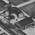
| + | File:KochMap4.jpg|Illustration of roundhouse from 1896 [[Koch map]]. | ||
</gallery> | </gallery> | ||
Latest revision as of 19:39, 29 May 2011
A roundhouse serving the Pensacola & Atlantic and later Louisville & Nashville Railroads was located along the tracks north of Wright Street at 10th Avenue. It was surrounded by a large complex with storage areas, numerous rail lines, and a spur line out to Muscogee Wharf. This complex stretched from the L & N Depot eastward between Wright and Heinberg Streets to 14th Avenue.
It is depicted on the Wellge map of 1885 and the Koch map of 1896. The structure was demolished in Template:Burned 1932.


